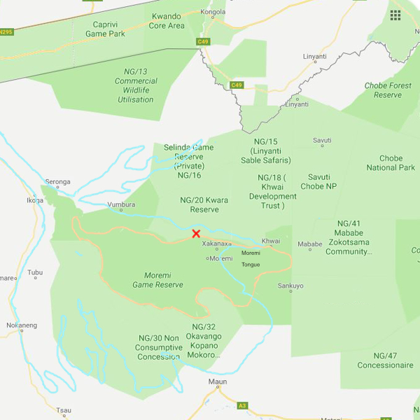
Largest extent of Okavango delta outlined in blue. Moremi Game Reserve in Orange
The small red cross shows the approximate location of Xobega Island
Click here to go to the Okavango/Moremi information page
Click here to go to the Moremi in August information page
The Moremi Game Reserve is located in North Western Botswana and is contiguous with and part of the Okavango delta. On the map opposite the Game Reserve is bordered in Orange and the approximate extent of the Okavango Delta is bordered in blue.
The area of flooding varies over the year with its peak around May where the river enters the delta from the panhandle, and between June and August further down towards Maun.
The peak flood is reached during Botswana's cooler dry season. This is because the water that feeds the delta falls in the hills on Angola around 1600km away to the North, and takes several months to reach the delta.
For the puposes of this site, the drier areas accessible by land have been called 'Moremi' in the galleries, and the wetter flooded areas only accessible by boat are referred to as 'Okavango', but strictly much of Moremi lies within the area covered by the peak floods of the Okavango delta itself.