The dry season is characterized by clear blue skies which lead to cold nights in winter
This is the largest inland delta (strictly it is an alluvial fan)
Occupies part of the Northwestern Kalahari basin
The water of the Okavango originates from Angola, which receives far more rain than Botswana
Known as the Cubango river before it reaches Botswana
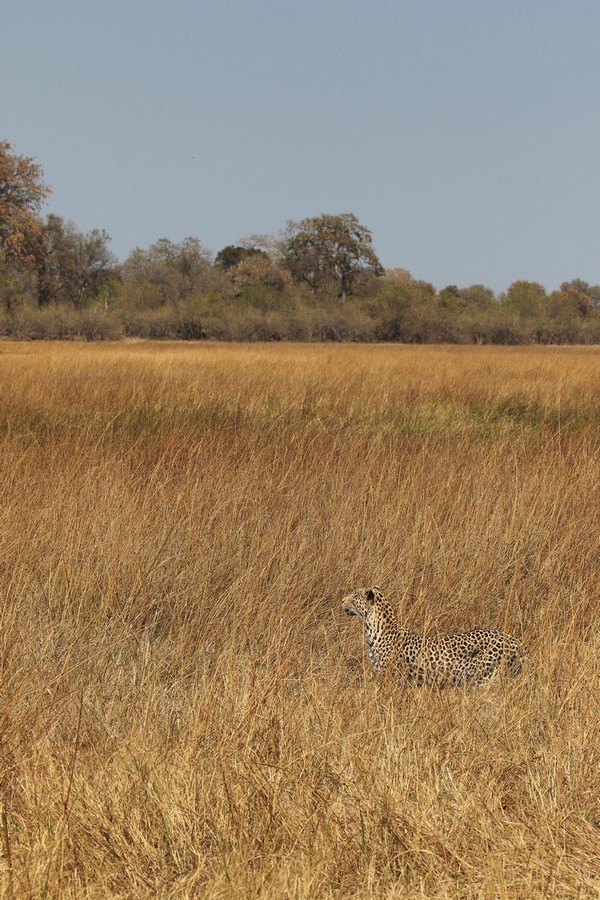
Leopard on a dried out flood plain in Moremi Game Reserve
Rainy season is mid November to April with very hot days to 40 C and warm nights
Winter June to August and nights can get to freezing although days are around 25 C
Floodwaters reach Okavango panhandle in May
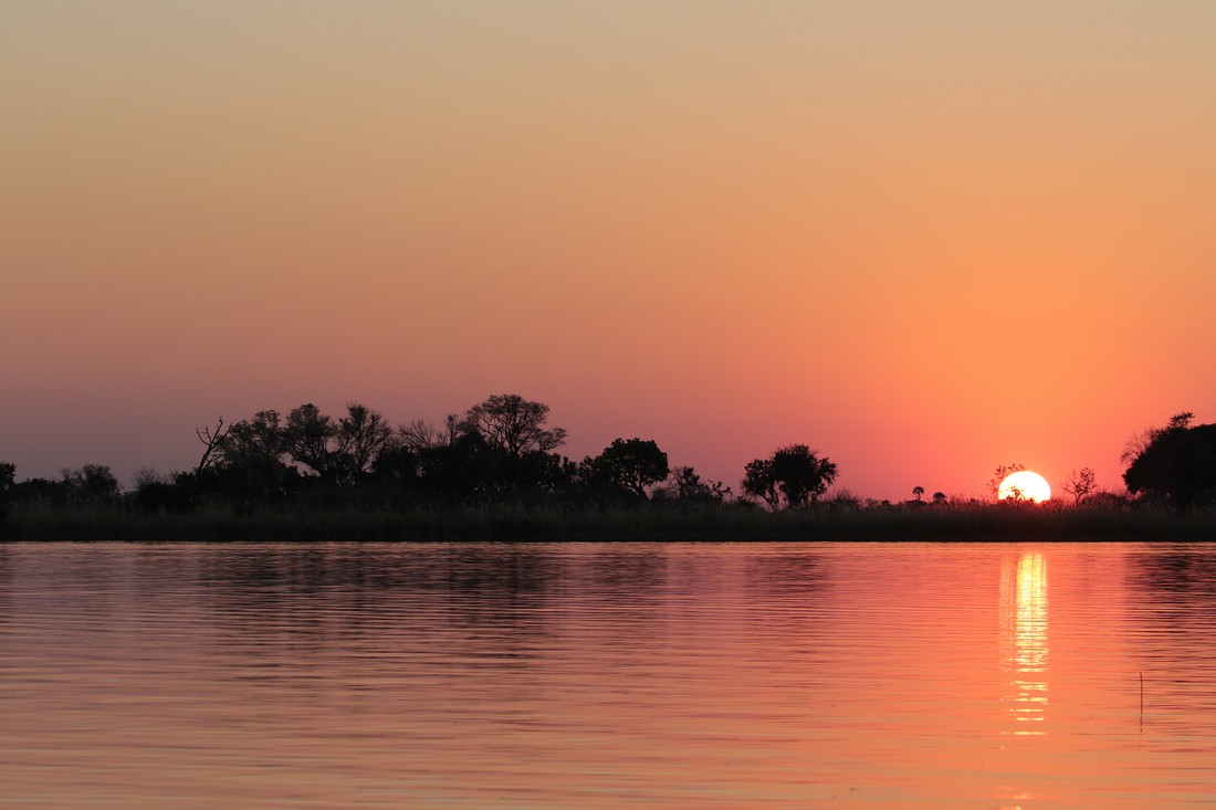
Floods peak at far end of delta in August in the dry season
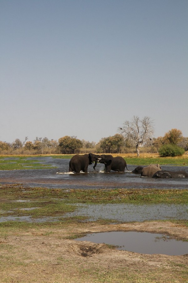
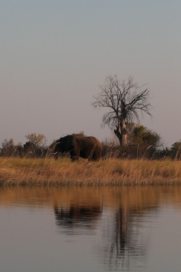
Elephants abound throughout the waterways of the Okavango. They help to keep channels open and create new ones
Many types of migrant birds such as carmine bee-eaters begin to arrive in September
October and November are the hottest driest months
Once rainfall starts many animals disperse from the region and the main calving season begins
Wildlife in the area includes Red lechwe, an antelope tied to the wetlands, and the elusive sitatunga in the more remote parts of the delta
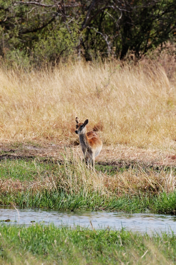
This is the place to be to see the red lechwe. Around 50000 live in the delta6
Southern limit of Okavango is the Thamalakane river which is the result of a 2 million year old fault of the same name
The whole area is very flat
5000 km2 Moremi Game reserve occupies part of the Eastern and central delta
The ease of getting around Moremi varies as to the seasonal flooding
A great area to explore by boat or mokoro
Very few Tsetse flies thanks to an effective method of exterminating them
We had no issues with mosquitos in August
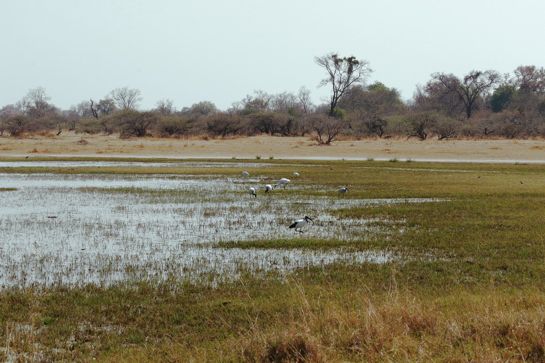
Floodwater peaked here in Moremi in late
August and was just starting to receed,
leaving a green and verdant floodplain with
plenty of new grasses to attract birds and
other wildlife
Most of the waters of the Okavango originate in the highlands of Angola, 1600km to the northwest. Angola receives three times as much rainfall as Botswana. Rainwater from the Angolan highlands flows into the Cubango River which crosses through Namibia and into Botswana. When the river reaches Botswana, it becomes the Okavango River, which then filters into the delta (map).
It takes a month for water travel the first 1,000 km of the Okavango River, and then a further four months to filter through the plants and numerous channels of the final 250 km of the delta. As a result, paradoxically the flood is at its biggest sometime between June and August, during Botswana’s dry winter months. The delta by then swells to nearly three times its permanent size, from 6000-15000 km, attracting animals from miles around and creating one of Africa’s greatest concentrations of wildlife.
In the rainy season, an outflow to the Boteti River in turn seasonally discharges to the Makgadikgadi Pans, which features an expansive area of rainy-season wetland where tens of thousands of flamingos congregate each year. Part of the river's flow fills Lake Ngami.
Millions of years ago, the Okavango flowed onwards into Lake Makgadikgadi, before geological changes (upthrust faulting) altered its course and the lake permanently dried up.
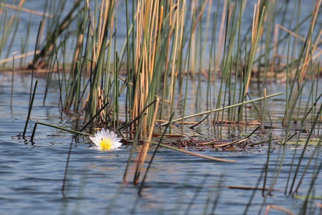
Many of the lakes and channels are only a
few feet deep, and water lillies grow profusely
in the clear water
The river enters the Kalahari from the Northwest through what is known as the panhandle. This is a relatively narrow channel 100km long between two geological plates. At the end of it the waters spread out into the permanent swamp.
The kalahari is an endorheic basin. That is defined as: a limited drainage basin that normally retains water and allows no outflow to other external bodies of water, such as rivers or oceans, but converges instead into lakes or swamps, permanent or seasonal, that equilibrate through evaporation. So all the water reaching the delta is ultimately evaporated and transpired by plants, as it does not flow into any sea or ocean. Each year, about 11 cubic kilometres (2.6 cu mi) of water spread over the delta.
The delta was defined in part by the actions of the Gumare fault to the North and the Thalamakane fault to the south. The land beneath these faults dropped (and southern Botswana rose)and effectively cut of the river's original direction of flow.
The water levels at any point in the Okavango Delta depend mainly on three variables: first, the local rainfall in a location; second, the height of the seasonal flood of the Okavango; and third, the location within the Delta – the further north in the Okavango, the more water there is likely to be.
There is less than 2 metres variation in height across the
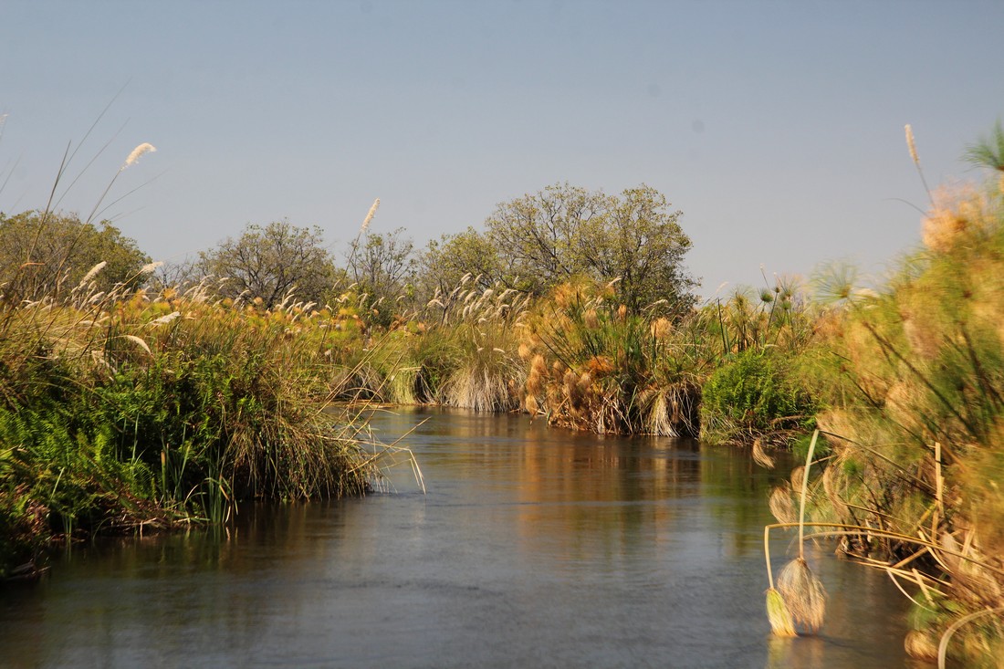
View from the boat on one of the many small
channels in the delta. Waterberry trees are
commonly seen growing along the banks
delta which contributes to the formation of the myriad waterways.
The delta covers up to 15,000km² at its peak with a lush water filled wilderness of papyrus swamps, shallow reed beds and floodplains, which are dotted with islands and laced with a network of channels. There are around 150,000 islands. The largest island in the delta is Chief’s Island, which is around 70km long and 14km wide and was once the private hunting reserve of a local chief.
Due to the filtration through the sand and papyrus the water is generally crystal clear.
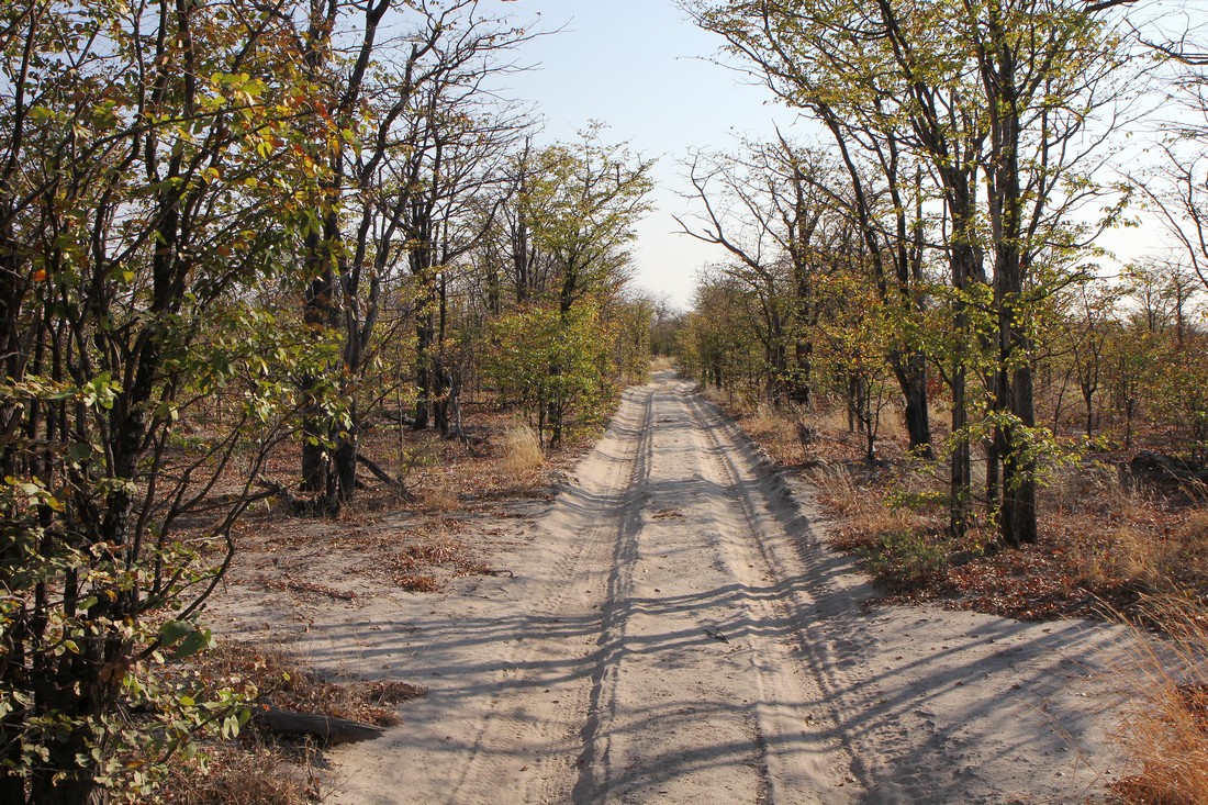
Beside the delta's many watercourses there are extensive floodplains, and stretches of riverine forests which do contain a wide range of species of bushes and trees. Open areas dotted with camelthorn trees follow the sandy beds of ancient channels, joined by silver terminalias, wild seringas and Kalahari apple-leaf trees.
In some of the drier parts of Moremi, mopane
woodland is the dominant feature. Mopane
can be deciduous or evergreen depending on
the environmental conditions wherever it grows
The population of wildlife is estimated to be 260,000 mammals in the dry season. As one of the only sources of water at this time of the year the Okavango Delta attracts thousands of animals creating one of Africa’s greatest concentrations of wildlife. Red Lechwe are the most populous large mammals, with around 60,000 of them living here permanently.
The Moremi Game Reserve, covers the central and eastern side of the Delta. In 1962 the local BaTawana people set aside a third of the Okavango Delta to protect it. The reserve encompasses a large area of the Delta's wetlands and floodplains, and the main dry peninsula that juts into the Delta, known as the Mopane Tongue. This map will give you a general idea of the area.
The tongue juts into the Delta from the east, between the Khwai and Mogogelo rivers. Each side of this is about 40km long, and roughly marking the corners are South Gate, North Gate and Xakanaxa. Aside from the riverine forest which lines its edges, the vast majority of the interior of this peninsula is covered in mopane woodland – with areas of very mature and beautiful specimens.
Xobega Island (where we stayed for part of our visit) is in
Sunset on the delta near xobega island
the North eastern Moremi wetland and is only accessible by boat.
The Okavango Delta has nearly 500 bird species, many of which are distributed in association with particular habitats.
Elephant, hippos and buffalo occur here year-round in large numbers, and you're likely to see blue wildebeest, zebra, impala, kudu, tsessebe, red lechwe, waterbuck, reedbuck, giraffe, steenbok, bushbuck, warthog, baboon and vervet monkey throughout the Okavango Delta.
Eland, sable and roan antelope are there but are less common. The deep-water and papyrus areas of the Delta have thriving populations of very shy sitatunga.
On our visit we actually saw some sitatunga for all of three seconds before they fled.
Lion, leopard, cheetah, spotted hyena and painted wolves all do well here and they're easiest to find on the northern and eastern sides of the Delta.
Up until 2001, rhino had been exterminated from here by poaching. Then in October 2001 the first white rhino were reintroduced into the Mombo Reserve, within Moremi Game Reserve. Black rhino followed in 2003.
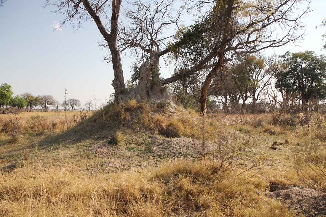
A disused termite mound in the process of
being colonized by trees and other plants.
In the wet season the trees will remain above
the flood water on the plain
Island building
In most parts of Africa the working part of a termite mound is underground and all that shows is the characteristic ventilation funnel, but in the Okavango Delta the structure has to be built above the water table, and the water table is virtually on the surface here. The termites raise their structure above this level to avoid it being flooded.
Birds spread the seeds of various trees to the tops of the mounds in their droppings. Soon small trees appear.
Tree roots help to hold the soil together, and the height and size of the mound increases. Eventually the mound becomes a small island. 70% of islands here are formed by colonizing old termite mounds.
Many of the islands are encircled by riverine vegetation of tall trees and bushes, and have a center of bare whitish soil. This is due to concentrated amounts of trace minerals which make the soil too acidic for other plants to grow.
In the Okavango delta seasonal fires clear channels
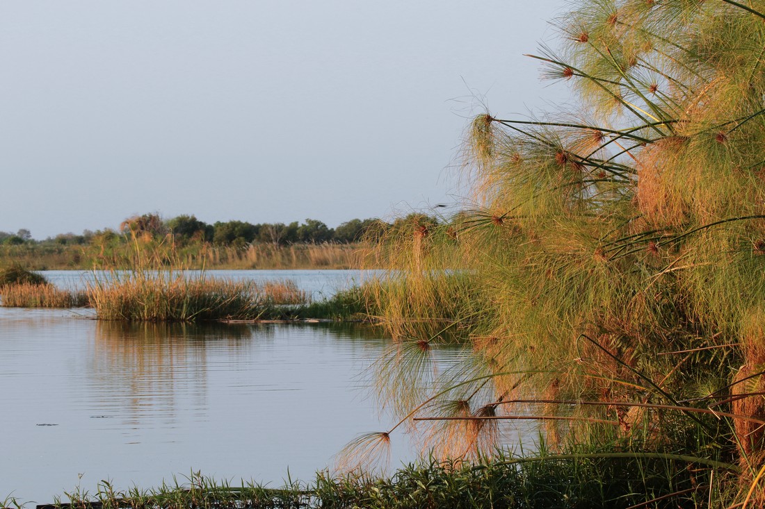
Papyrus (right) grows extensively in the delta
and especially along the panhandle. Seasonal
fires help to keep them in check and stop them
clogging up even more of the channels.
blocked by old and rotting papyrus, allowing for water to flow more freely and to bring on new growth.
There are two times when fires will burn - in late winter when the water on the floodplains is shrinking fast and the grass becomes brittle and dry, and again before the arrival of the floodwaters when the grass on the plains, that grew in the rainy season, is shrivelling.
Large herbivores like hippos and elephants also serve as engineers to keep existing waterways open and create new ones by acting as bulldozers.
Watch the Okavango in August video.